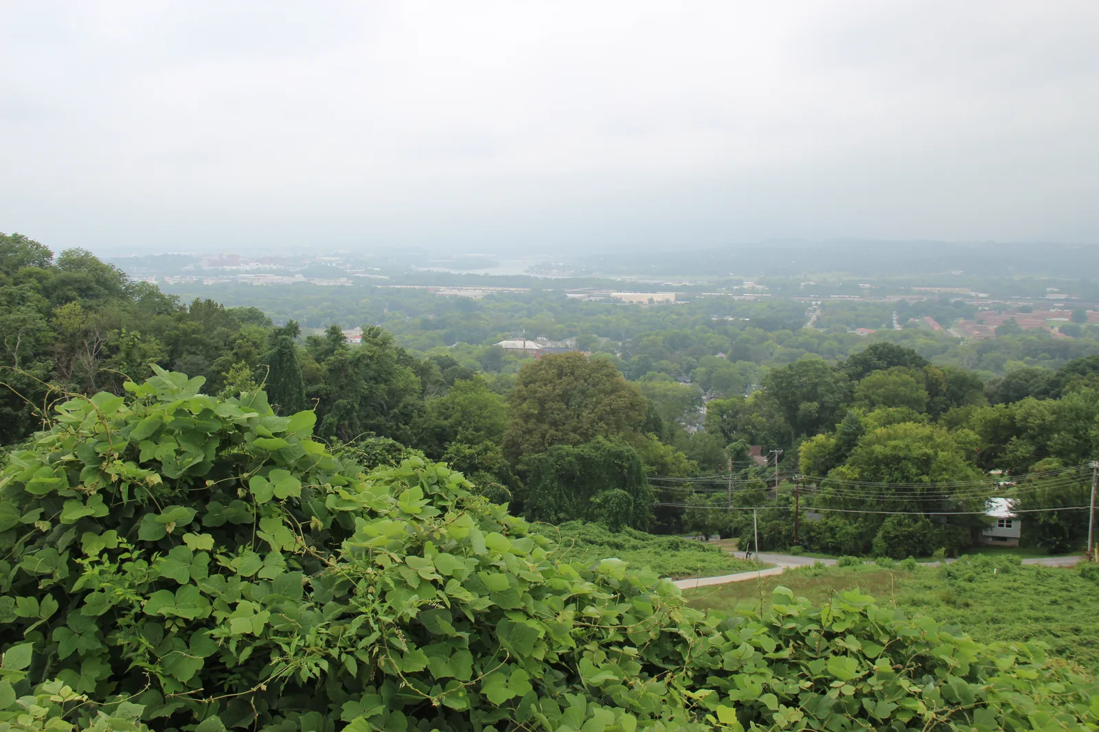
Ten Chattanooga areas, from downtown and St. Elmo to Hixson and East Brainerd, with zoned high schools, ZIP codes and Zillow home values.
Last checked Oct. 18, 2026. Sources: the City of Chattanooga’s GIS map layers (neighborhood association and HOA registry, city limits, ZIP codes, parks and trails); the Chattanooga-Hamilton County Regional Planning Agency’s planning-area map and Plan Chattanooga; Hamilton County Schools’ 2026-27 school zones map; the Tennessee Department of Education’s 2024-25 letter grades; Zillow Research; the Census Bureau’s QuickFacts; and OpenStreetMap.
Chattanooga is a city of about 186,000 people in Hamilton County, on both banks of the Tennessee River where it bends around Moccasin Bend. Ridges shape it: Lookout Mountain to the southwest, Missionary Ridge east of downtown and Signal Mountain and Walden’s Ridge to the north. I-24 runs east to west across the south side and over Missionary Ridge, I-75 comes up from Georgia through East Brainerd to meet it, and U.S. 27 runs north from I-24 through downtown and across the river. Highway 153 crosses the Chickamauga Dam to Hixson.
Three things trip up newcomers:
- City limits. Chattanooga addresses and ZIP codes reach well outside the city. Red Bank, East Ridge, Ridgeside and Lookout Mountain are separate cities, and parts of the Hixson and Lookout Valley planning areas are unincorporated county. Homes inside the city pay both city and Hamilton County property taxes; see our property taxes guide.
- ZIP codes. Most Chattanooga ZIP codes cross neighborhood and city lines, so a ZIP code alone does not tell you which neighborhood, city or school zone a home is in.
- School zones. One district, Hamilton County Schools, runs every public school, but its zones do not follow city or neighborhood lines. North Chattanooga is zoned for Red Bank High; most of St. Elmo for Lookout Valley Middle/High; East Brainerd is split between East Hamilton and Ooltewah. Check any address in the district’s School Zone Finder. See our schools guide.
Plan Chattanooga, the comprehensive plan the City Council adopted on Sept. 22, 2026, splits the city into eight planning areas. This guide uses those areas for the large suburban parts of the city and the city’s own neighborhood association boundaries for the older, smaller neighborhoods.
The areas at a glance
Zoned high school is the one serving most residents, from the district’s 2026-27 zones. Home values are the Zillow Home Value Index for the area’s main ZIP code in September 2026, a modeled typical value, not a sale price.
| Area | Main ZIP | Zoned high school (2024-25 grade) | Typical home value | Guide |
|---|---|---|---|---|
| Downtown | 37402 | The Howard School (D) | $442,590 | Downtown |
| North Chattanooga | 37405 | Red Bank High (C) | $449,993 | North Chattanooga |
| Highland Park | 37404 | The Howard School (D) | $252,767 | Highland Park |
| St. Elmo | 37409 | Lookout Valley Middle/High (C) | $383,793 | St. Elmo |
| East Lake | 37407 | The Howard School (D) | $121,740 | East Lake |
| Brainerd | 37411 | Brainerd High (D) | $228,912 | Brainerd |
| East Brainerd | 37421 | East Hamilton High (A) | $357,190 | East Brainerd |
| Hixson | 37343 | Hixson High (B) | $360,948 | Hixson |
| Lookout Valley | 37419 | Lookout Valley Middle/High (C) | $368,807 | Lookout Valley |
| Highway 58 and Tyner | 37416 | Central High (D) | $286,273 | Highway 58 and Tyner |
The City of Chattanooga figure was $314,999, down 1.3% from September 2025. More in our home prices guide.
Map
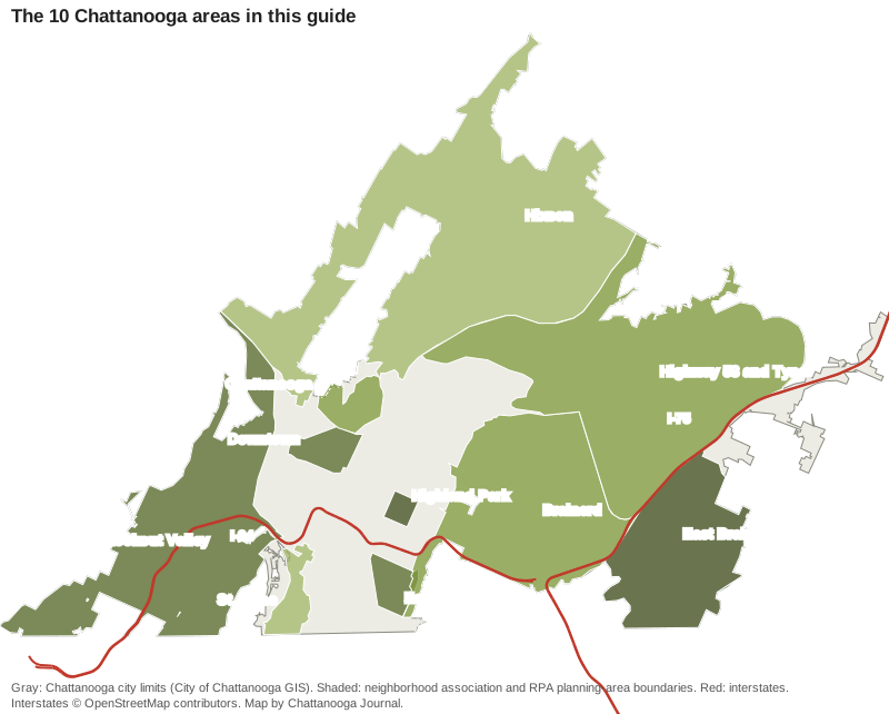
Map: Chattanooga Journal, from the City of Chattanooga’s city limits and neighborhood association boundaries and the Regional Planning Agency’s planning areas. Interstates © OpenStreetMap contributors.
Downtown
The city center on the south bank, from Ross’s Landing south along Market and Broad streets, with Coolidge Park across the river. About 1.5 square miles, mostly ZIP 37402, mostly zoned for The Howard School. Read the downtown guide.
North Chattanooga
The hillside neighborhood across the river, with Hill City west of North Market Street and Stringers Ridge. All of it is in 37405 and zoned for Red Bank High; about two-thirds is zoned for Normal Park Museum Magnet. Read the North Chattanooga guide.
Highland Park
A half-square-mile streetcar-era neighborhood east of downtown in the Historic River-to-Ridge area, home to the former Tennessee Temple University campus and three public charter schools. Read the Highland Park guide.
St. Elmo
A local historic district at the foot of Lookout Mountain, where the Incline Railway starts. Most of it is zoned for Lookout Valley Middle/High, and the Tennessee Riverwalk reaches it. Read the St. Elmo guide.
East Lake
A South Chattanooga neighborhood along Rossville Boulevard, built around East Lake Park and its spring-fed pond, about a mile from I-24. Read the East Lake guide.
Brainerd
About 17 square miles east of Missionary Ridge along Brainerd Road, including Eastgate Town Center and the airport. Mostly zoned for Brainerd High, with the South Chickamauga Creek Greenway and two city golf courses. Read the Brainerd guide.
East Brainerd
The city’s southeast corner east of I-75, around Hamilton Place and Gunbarrel Road, split between the East Hamilton and Ooltewah school zones. The city’s registry lists 29 neighborhood groups and HOAs here. Read the East Brainerd guide.
Hixson
About 35 square miles of the city north of the river along Hixson Pike and Highway 153, around Northgate Mall and surrounding the separate city of Red Bank. Split between Hixson High and Red Bank High. Read the Hixson guide.
Lookout Valley
The city’s western edge beyond Lookout Mountain, along I-24 and Cummings Highway, with its own middle and high school, Lookout Valley Middle/High. No CARTA bus route serves it. Read the Lookout Valley guide.
Highway 58 and Tyner
The northeast side between Chickamauga Lake and I-75, with Enterprise South Nature Park, the Volkswagen plant and Chattanooga State. Split between Central High and Tyner Academy. Read the Highway 58 and Tyner guide.
Chattanooga in numbers
From the Census Bureau’s 2020-2024 American Community Survey five-year estimates, shown on QuickFacts:
| Measure | Chattanooga |
|---|---|
| Population | 185,783 |
| Median household income | $64,523 |
| Median value of owner-occupied homes | $283,200 |
| Mean travel time to work | 18.5 minutes |
How Chattanooga compares with Red Bank, East Ridge and Signal Mountain on taxes, schools and home values is in our Chattanooga vs Red Bank vs East Ridge vs Signal Mountain guide. New to town? Start with our moving here guide and getting around guide.
How we built this
The areas come from two official maps. For the older neighborhoods (Downtown, North Chattanooga with Hill City, Highland Park, St. Elmo and East Lake) we used the City of Chattanooga’s neighborhood association boundaries. For the larger suburban areas (Brainerd, East Brainerd, Hixson, Lookout Valley, and Highway 58 and Tyner) we used the Regional Planning Agency’s planning areas, which match the area chapters of Plan Chattanooga, clipped to the city limits. Every name but Downtown also appears as a place on OpenStreetMap. We left out neighborhoods we could not draw from a published boundary. School zones and ZIP code shares come from 2020 census block points inside each area, checked Oct. 18, 2026; road distances come from the OpenStreetMap road network.
Frequently asked questions
What are the neighborhoods in Chattanooga, Tennessee?
The city’s neighborhood registry lists about 140 neighborhood associations and HOAs, and Plan Chattanooga divides the city into eight planning areas. This guide covers 10 areas: Downtown, North Chattanooga, Highland Park, St. Elmo, East Lake, Brainerd, East Brainerd, Hixson, Lookout Valley, and Highway 58 and Tyner.
Does a Chattanooga address mean a home is inside the city?
No. Chattanooga mailing addresses and ZIP codes reach into unincorporated Hamilton County and into separate cities such as Red Bank and East Ridge. Homes inside the city pay both city and county property taxes, so check a parcel’s city on the county assessor’s property search.
Which high school will my Chattanooga home be zoned for?
Hamilton County Schools runs every public school in the city and county, and its zones do not follow city or neighborhood lines. North Chattanooga, for example, is zoned for Red Bank High and most of St. Elmo for Lookout Valley Middle/High. Check the address in the district’s School Zone Finder.
What is the typical home value in Chattanooga?
$314,999 in September 2026, down 1.3% in a year, according to the Zillow Home Value Index, a modeled value for the middle third of homes, not a sale price. Among the ZIP codes in this guide it ran from $121,740 in 37407 to $449,993 in 37405.
Have your say