Chattanooga's Highway 58 and Tyner area is zoned for Central High or Tyner Academy. Zillow put ZIP 37416 at $286,273 in September 2026, down 1.2%.
Last checked Oct. 18, 2026. Sources: the Chattanooga-Hamilton County Regional Planning Agency’s planning-area map and Plan Chattanooga, the city’s comprehensive plan; the City of Chattanooga’s GIS map layers (city limits, neighborhood association and HOA registry, ZIP codes, parks and trails); Hamilton County Schools’ 2026-27 school zones map; the federal NCES school directory; the Tennessee Department of Education’s 2024-25 letter grades; Zillow Research; CARTA’s published schedule data; and OpenStreetMap.
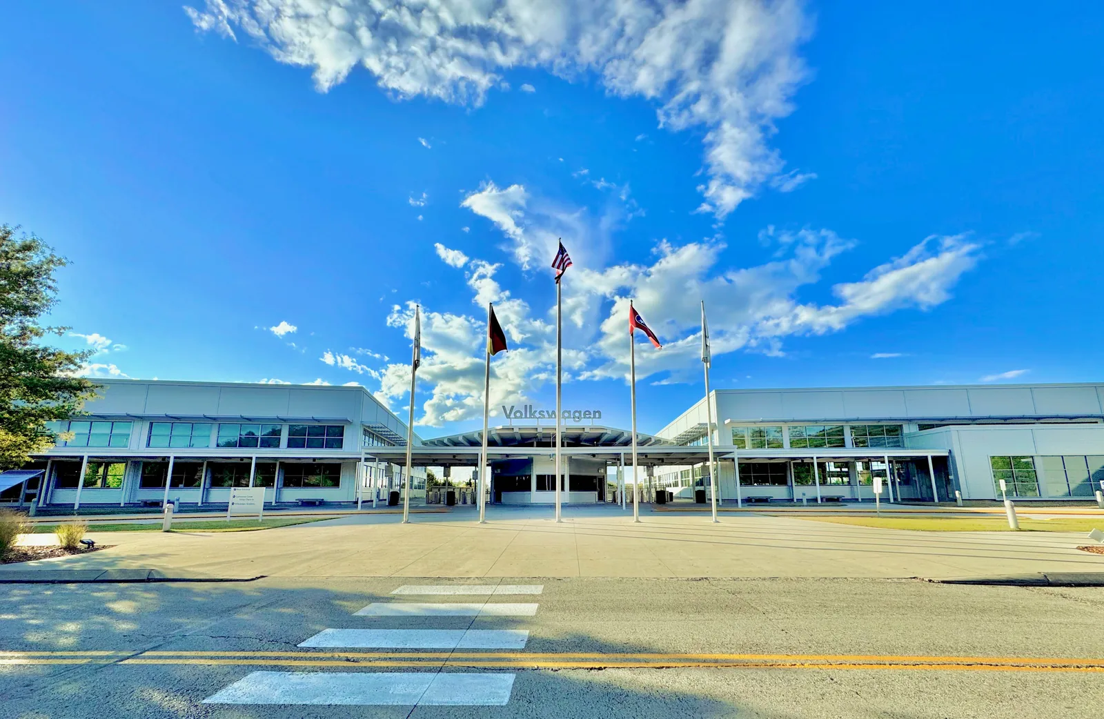
The Highway 58 and Tyner area is Chattanooga’s northeast side, from the shore of Chickamauga Lake east to I-75, taking in the old Tyner community, the Highway 58 corridor, Chattanooga State Community College and the Enterprise South Industrial Park, home of the Volkswagen plant. It covers about 29 square miles, where about 20,500 people lived in the 2020 census.
What this means for you
- Zoned high school: Central High for about 48% of residents (graded D for 2024-25) and Tyner Academy (graded B) for about 46%.
- Home value: $286,273 in ZIP code 37416 in September 2026, according to the Zillow Home Value Index.
- Nearest interstate exit: I-75 exit 7 (Bonny Oaks Drive and Old Lee Highway), about 1.5 miles by road from Tyner Park.
Part of our Chattanooga neighborhoods guide.
Where it is
Plan Chattanooga, which the City Council adopted on Sept. 22, 2026, calls this Area 10, Highway 58 / Tyner, and says it “stretches from the shores of the Chickamauga Lake east to Interstate 75.” It encompasses the 6,000-acre Enterprise South Industrial Park, built on the former Volunteer Army Ammunition Plant, and the more than 2,700-acre Enterprise South Nature Park. On the Regional Planning Agency’s map, all of Area 10 is inside the city limits.
Highway 58, Bonny Oaks Drive, Lee Highway, Amnicola Highway, Shallowford Road and Hickory Valley Road are the main roads. The plan traces Highway 58 to the old Harrison Pike and says Tyner got its post office, and its name, in 1860, saw Tyner Academy open in 1907 and was incorporated into the City of Chattanooga in 1972. It notes little new housing in the last decade and says walking and biking routes are “significantly lacking.” About 53% of residents are in ZIP code 37416, 42% in 37421 and 5% in 37406.
Schools
From the Hamilton County Schools 2026-27 attendance zones, weighted by 2020 census population. Grades are each school’s overall grade on Tennessee’s 2024-25 letter-grade report card:
| Level | School | Address | 2024-25 grade | Where it is zoned |
|---|---|---|---|---|
| Elementary | Harrison Elementary | 8098 Ferdinand Piech Way | D | About 54%, the north |
| Elementary | Bess T. Shepherd Elementary | 7126 Tyner Road | B | About 46%, the south |
| Middle | Brown Middle | 5716 Highway 58 | B | About 48% |
| Middle | Tyner Middle Academy | 6837 Tyner Road | F | About 46% |
| High | Central High | 5728 Highway 58 | D | About 48% |
| High | Tyner Academy | 6836 Tyner Road | B | About 46% |
About 6% of residents, on the southwest edge, are zoned for Dalewood Middle and Brainerd High. The area is also home to three schools that take students from across the county, according to the NCES directory: Chattanooga School for the Liberal Arts, 4850 Jersey Pike, and STEM School Chattanooga and Hamilton County Collegiate High, both at Chattanooga State, 4501 Amnicola Highway. All three were graded A. Check an address in the district’s School Zone Finder. More in our schools guide.
Home values
The typical home value in ZIP code 37416 was $286,273 in September 2026, down 1.2% from $289,821 in September 2025, according to the Zillow Home Value Index. In 37421 it was $357,190, also down 1.2%. The index is a modeled typical value for the middle third of homes, not a sale price, and both ZIP codes reach beyond this area. The City of Chattanooga figure was $314,999, down 1.3%. More in our home prices guide.
Parks and trails
From the City of Chattanooga’s parks map layer:
- Tyner Park, 6900 Ty-Hi Drive.
- Lake Hills Park, 4395 Bellview Ave.
- Murray Hills Park, 4125 Melinda Drive.
- Washington Hills Park, 4628 Oakwood Drive.
- Shepherd Park, 2124 Shepherd Road.
- Lakeside Ballfields, 4800 Swan Road.
The city’s trail layer maps the Hamilton County trail network at Enterprise South Nature Park, the Tennessee Riverwalk and Tennessee Riverpark along Amnicola Highway, the Chickamauga Dam day use area and the South Chickamauga Creek Greenway. More in our parks and trails guide and walking and biking trails guide.
Getting around
- Interstate: I-75 exit 7 (Bonny Oaks Drive and Old Lee Highway) is about 1.5 miles by road from Tyner Park and exit 5 (Shallowford Road) about 2.3 miles.
- Downtown: about 13.9 miles by road to Miller Park.
- Airport: about 4.7 miles by road to Chattanooga Metropolitan Airport (CHA).
- Bus: CARTA Route 25 Enterprise South/Amnicola Highway has 41 stops in the area and Route 4 Eastgate/Hamilton Place 30, in CARTA’s current schedule data.
Distances are measured on the OpenStreetMap road network with the OSRM routing engine, from Tyner Park; exit distances run to the end of the off-ramp. They are distances, not drive times. More in our getting around guide.
HOAs and neighborhood groups
The city’s neighborhood association registry lists 18 groups here, in City Council Districts 5 and 6. Eight are homeowners or townhome associations, among them the Bal Harbor, Willow Trace, Hickory Manor, The Arbors, Vaden Village and Moss Landing homeowners associations. Voluntary groups include the Lake Hills, Washington Hills, Murray Hills and Mahala Acres neighborhood associations, the Midfield Acres Community Club and the Lake Chickamauga Community Association.
Groceries and everyday stores
From OpenStreetMap:
- On Highway 58: Food City, 4510; United Grocery Outlet, 4758; Walgreens, 4542; and CVS Pharmacy, 4700.
- On Lee Highway: Food City, 6651; Save-A-Lot, 6901; CVS Pharmacy, 6802; and Janta Farmers Market, 6500.
How we drew this area
The area is the Regional Planning Agency’s Area 10 (Highway 58 / Harrison / Tyner on its map, Highway 58 / Tyner in Plan Chattanooga). School zones and ZIP codes come from 2020 census block points inside it, checked Oct. 18, 2026. Store and road data are © OpenStreetMap contributors.
Frequently asked questions
What high school is Tyner and Highway 58 zoned for?
About 48% of residents in the area are zoned for Central High, 5728 Highway 58, graded D on Tennessee’s 2024-25 report card, and about 46% for Tyner Academy, 6836 Tyner Road, graded B, according to Hamilton County Schools’ 2026-27 zone map.
Is Tyner part of Chattanooga?
Yes. Plan Chattanooga says Tyner was incorporated into the City of Chattanooga in 1972, and on the Regional Planning Agency’s map the whole Highway 58 / Tyner planning area is inside the city limits.
What ZIP code is the Highway 58 area of Chattanooga?
Mostly 37416, with the south and east in 37421. Zillow’s typical home value for 37416 was $286,273 in September 2026, down 1.2% from a year earlier.
Is Tyner a good place to live?
Here are the facts. The Highway 58 and Tyner area covers about 29 square miles of Chattanooga between Chickamauga Lake and I-75, with Enterprise South Nature Park and six city parks, zoned for Central High (D for 2024-25) or Tyner Academy (B); the typical home value in ZIP 37416 was $286,273 in September 2026, according to Zillow.
Have your say