Chattanooga's Hixson area is zoned for Hixson High or Red Bank High. Zillow put ZIP 37343 at $360,948 in September 2026, up 0.3% in a year.
Last checked Oct. 18, 2026. Sources: the Chattanooga-Hamilton County Regional Planning Agency’s planning-area map and Plan Chattanooga, the city’s comprehensive plan; the City of Chattanooga’s GIS map layers (city limits, neighborhood association and HOA registry, ZIP codes, parks, trails and historic districts); Hamilton County Schools’ 2026-27 school zones map; the Tennessee Department of Education’s 2024-25 letter grades; Zillow Research; CARTA’s published schedule data; and OpenStreetMap.
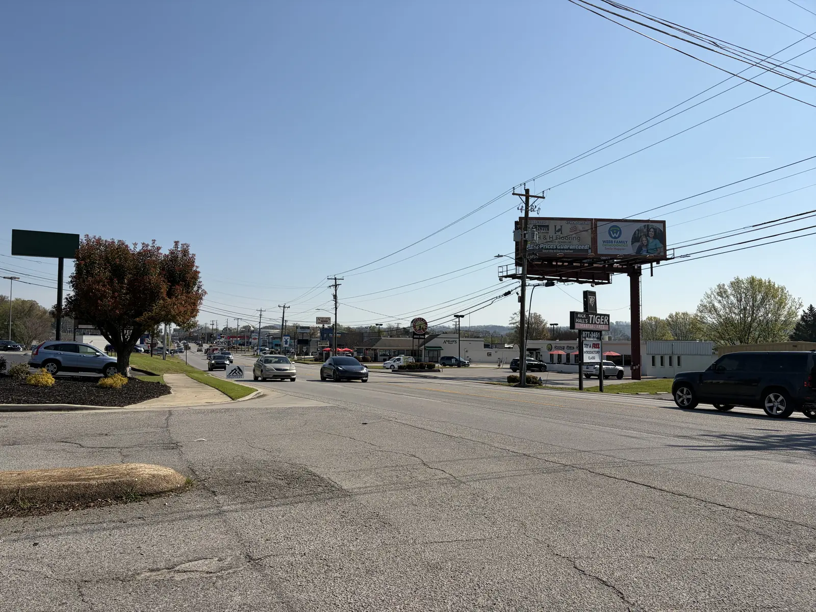
Hixson is the big northern part of Chattanooga across the Tennessee River, along Hixson Pike and Highway 153, with Northgate Mall at its center. Plan Chattanooga calls it “one of the early suburban areas of the city” with “a largely suburban and rural character.” The part inside the city covers about 35 square miles, where about 42,400 people lived in the 2020 census.
What this means for you
- Zoned high school: Hixson High for about 55% of residents (graded B for 2024-25); Red Bank High (C) for most of the rest.
- Home value: $360,948 in ZIP code 37343 in September 2026, according to the Zillow Home Value Index.
- Nearest freeway exit: TN 153 exit 6 (Amnicola Highway), about 4.8 miles by road from Hixson Park; the nearest interstate, I-75, is about 11.5 miles at exit 4.
Part of our Chattanooga neighborhoods guide.
Where it is
Plan Chattanooga, which the City Council adopted on Sept. 22, 2026, treats Hixson as Area 2, “approximately 38 square miles between the Tennessee River and Walden’s Ridge.” The area wraps around the City of Red Bank, a separate city the plan describes as “completely surrounded by the City of Chattanooga.” This guide uses the Regional Planning Agency’s Area 2 map clipped to Chattanooga’s city limits, which leaves out Red Bank and the unincorporated land to the north.
Hixson Pike runs the length of the area, with Highway 153, Dayton Boulevard, Mountain Creek Road, Signal Mountain Road and Suck Creek Road as the other main roads. The plan says Northgate Mall, opened in 1972, was Chattanooga’s first fully enclosed shopping mall, and that Highway 153 and the Thrasher Bridge opened the area to the rest of the county. It also covers Mountain Creek, the approach to Signal Mountain, and Lupton City, “a historic residential neighborhood” built in the 1920s as a company town for the Dixie Mercerizing Company, which the city’s map shows as a preliminary local historic district.
About 57% of residents are in ZIP code 37343, 29% in 37415 and 13% in 37405.
Schools
From the Hamilton County Schools 2026-27 attendance zones, weighted by 2020 census population. Grades are each school’s overall grade on Tennessee’s 2024-25 letter-grade report card:
| Level | School | Address | 2024-25 grade | Where it is zoned |
|---|---|---|---|---|
| Elementary | Big Ridge Elementary | 5210 Cassandra Smith Road | B | About 25%, the east |
| Elementary | Hixson Elementary | 5950 Winding Lane | B | About 20% |
| Elementary | Red Bank Elementary | 1100 Mountain Creek Road | C | About 20%, the west |
| Elementary | DuPont Elementary | 4134 Hixson Pike | D | About 15% |
| Elementary | Rivermont Elementary | 3330 Hixson Pike | C | About 12%, the south |
| Middle | Hixson Middle | 5401 School Drive | C | About 55% |
| Middle | Red Bank Middle | 3715 Dayton Blvd. | D | About 45% |
| High | Hixson High | 5705 Middle Valley Road | B | About 55% |
| High | Red Bank High | 640 Morrison Springs Road | C | About 45% |
Alpine Crest Elementary (graded B) covers about 5% and Middle Valley Elementary (A) about 3%. With this many zones, check the exact address in the district’s School Zone Finder. More in our schools guide.
Home values
The typical home value in ZIP code 37343 was $360,948 in September 2026, up 0.3% from $360,028 in September 2025, according to the Zillow Home Value Index. In 37415, the southern part, it was $325,510, down 1.2%. The index is a modeled typical value for the middle third of homes, not a sale price, and both ZIP codes reach outside the city. The City of Chattanooga figure was $314,999, down 1.3%. More in our home prices guide.
Parks and trails
From the City of Chattanooga’s parks map layer:
- Hixson Park, 5401 School Drive, and the Hixson Ballfields, 5410 School Drive.
- DuPont Park, the DuPont Ball Fields, the North River Soccer Complex and The Sinks Disc Golf Course, all on North Access Road.
- Greenway Farm, 3008 Hamill Road.
- Rivermont Park, 1096 Lupton Drive.
- Lupton Mills Meadow Park, 2 Dixie Circle.
- Mountain Creek Road Park, 1102 Mountain Creek Road, and Portland Park on Suck Creek Road.
The North Chickamauga Creek Greenway and trails at Greenway Farm, Hixson Park and Mountain Creek Park are on the city’s trail map. More in our parks and trails guide.
Getting around
- Freeway: TN 153 exit 6 (Amnicola Highway) is about 4.8 miles by road from Hixson Park and exit 5 (TN 58) about 5.9 miles; I-75 exit 4 is about 11.5 miles.
- Downtown: about 9.1 miles by road to Miller Park.
- Airport: about 10.2 miles by road to Chattanooga Metropolitan Airport (CHA).
- Bus: CARTA Route 16 Northgate has 65 stops in the area in CARTA’s current schedule data, mostly along Hixson Pike.
Distances are measured on the OpenStreetMap road network with the OSRM routing engine, from Hixson Park; exit distances run to the end of the off-ramp. They are distances, not drive times. More in our getting around guide.
HOAs and neighborhood groups
The city’s neighborhood association registry lists 24 groups in this area, in City Council Districts 1, 2 and 3. A dozen are homeowners or owners associations, among them the Valleybrook Homeowners Association, the Heritage Ridge Homeowners Association, the Ramsgate HOA, the Jackson Square HOA and the Bay Pointe Estates and Marina Cove Place associations. Voluntary neighborhood associations include Stuart Heights, Dallas Heights, Manchester Park, Colonial Shores, Kensington Forest and the Fairfax Heights-Bagwell City-Lupton City Neighborhood Association.
Groceries and everyday stores
From OpenStreetMap:
- On Hixson Pike: Publix, 5928; Walmart Neighborhood Market, 3901.
- On Highway 153: Walmart Supercenter, 5764; ALDI, 5510; CVS Pharmacy, 5579.
- Walmart Supercenter, 501 Signal Mountain Road, and ALDI, 637 Mundy St.
How we drew this area
The area is the Regional Planning Agency’s Area 2 (Hixson / Red Bank on its map, Hixson in Plan Chattanooga) clipped to the City of Chattanooga’s city limits. School zones and ZIP codes come from 2020 census block points inside it, checked Oct. 18, 2026. Store and road data are © OpenStreetMap contributors.
Frequently asked questions
What high school is Hixson zoned for?
In the city’s Hixson area, about 55% of residents are zoned for Hixson High, 5705 Middle Valley Road, graded B on Tennessee’s 2024-25 report card, and about 45% for Red Bank High, graded C, according to Hamilton County Schools’ 2026-27 zone map.
Is Hixson part of Chattanooga?
Partly. Hixson is a community, not a separate city. About 35 square miles of the Hixson planning area are inside Chattanooga city limits; the rest is unincorporated Hamilton County or the City of Red Bank, so check a parcel’s city before comparing taxes.
What ZIP code is Hixson?
Mostly 37343, with the southern part in 37415 and 37405. Zillow’s typical home value for 37343 was $360,948 in September 2026, up 0.3% from a year earlier.
Is Hixson a good place to live?
Here are the facts. The city’s Hixson area covers about 35 square miles between the Tennessee River and Walden’s Ridge with a dozen city parks and ballfields, zoned for Hixson High (graded B for 2024-25) or Red Bank High (C); the typical home value in ZIP 37343 was $360,948 in September 2026, according to Zillow.
Have your say