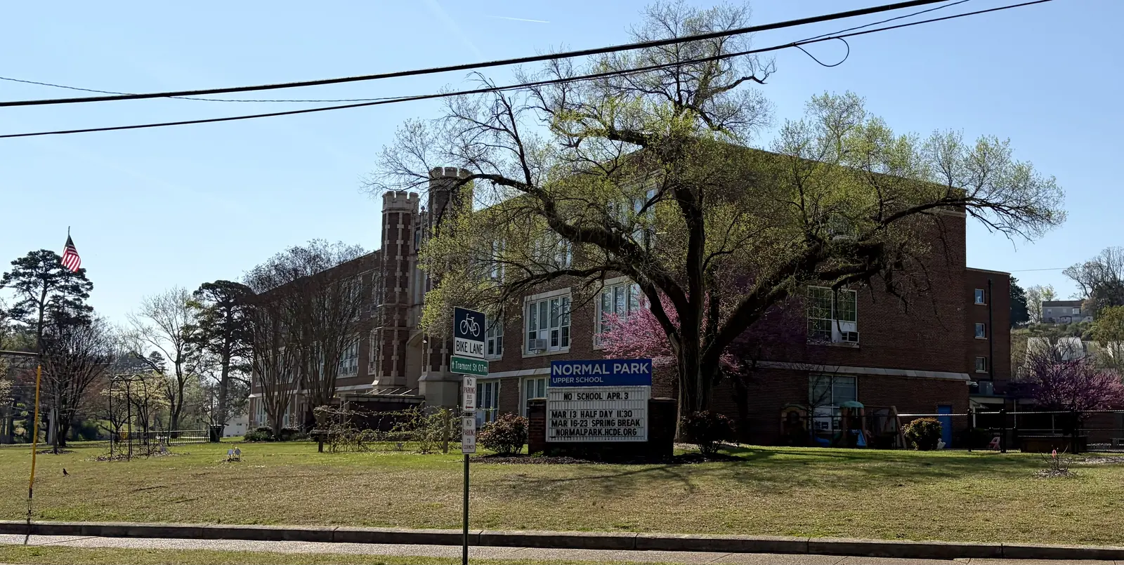
North Chattanooga and Hill City are zoned for Normal Park and Red Bank High. Zillow put ZIP 37405 at $449,993 in September 2026, up 0.8% in a year.
Last checked Oct. 18, 2026. Sources: the City of Chattanooga’s GIS map layers (neighborhood association boundaries and registry, ZIP codes, parks and trails); Plan Chattanooga, the city’s comprehensive plan; Hamilton County Schools’ 2026-27 school zones map; the Tennessee Department of Education’s 2024-25 letter grades; Zillow Research; CARTA’s published schedule data; and OpenStreetMap.
North Chattanooga is the hillside neighborhood across the Tennessee River from downtown, reached by the Walnut Street, Market Street and Veterans bridges. This guide takes it together with Hill City, the blocks west of North Market Street that the city’s comprehensive plan says are “still referred to as such” from a community founded after the Civil War. The two cover about 1.7 square miles, where about 6,600 people lived in the 2020 census.
What this means for you
- Zoned high school: Red Bank High for the whole area (graded C for 2024-25).
- Home value: $449,993 in ZIP code 37405 in September 2026, according to the Zillow Home Value Index.
- Nearest freeway exit: U.S. 27 exit 1C (Fourth Street), about 1.8 miles by road from North Chattanooga Park.
Part of our Chattanooga neighborhoods guide.
Where it is
This guide follows the North Chattanooga and Hill City boundaries on the City of Chattanooga’s neighborhood association map. The main roads are Frazier Avenue along the river, North Market Street, Barton Avenue, Hixson Pike and Cherokee Boulevard, with Stringers Ridge on the west side. All of it is in ZIP code 37405, and all of it is inside the city.
Plan Chattanooga, which the City Council adopted on Sept. 22, 2026, puts the neighborhood in Area 1, Downtown / North Shore. Residents who took part in the plan’s surveys asked for safer traffic on Frazier Avenue and called Stringers Ridge “a well-designed and connected park,” and the plan proposes a mobility hub at the North Chattanooga Community Center. The shops and restaurants along Frazier Avenue and Coolidge Park sit at the river’s edge; Coolidge Park is inside the city’s downtown boundary, covered in our downtown guide.
Schools
From the Hamilton County Schools 2026-27 attendance zones, weighted by 2020 census population. Grades are each school’s overall grade on Tennessee’s 2024-25 letter-grade report card:
| Level | School | Address | 2024-25 grade | Where it is zoned |
|---|---|---|---|---|
| K-8 | Normal Park Museum Magnet | 1009 and 1219 Mississippi Ave. | B | About 68%, the center and east |
| Elementary | Red Bank Elementary | 1100 Mountain Creek Road | C | About 19% |
| Elementary | Rivermont Elementary | 3330 Hixson Pike | C | About 13% |
| Middle | Red Bank Middle | 3715 Dayton Blvd. | D | About 32%, outside the Normal Park zone |
| High | Red Bank High | 640 Morrison Springs Road | C | All |
The district’s zone map lists two Normal Park campuses on Mississippi Avenue, at 1009 and 1219. Chattanooga High School Center for Creative Arts, a countywide fine arts magnet graded A, is at 1301 Dallas Road. Check an address in the district’s School Zone Finder. More in our schools guide.
Home values
The typical home value in ZIP code 37405 was $449,993 in September 2026, up 0.8% from $446,369 in September 2025, according to the Zillow Home Value Index. The index is a modeled typical value for the middle third of homes, not a sale price, and 37405 also covers Riverview and areas farther north. The City of Chattanooga figure was $314,999, down 1.3%. More in our home prices guide.
Parks and trails
From the City of Chattanooga’s parks map layer:
- Stringers Ridge, with trailheads at 707 W. Bell Ave. and 1312 Spears Ave.
- North Chattanooga Park, 406 May St., next to the community center.
- Hill City Park, 18 Trewhitt St.
- Frances B. Wyatt Park, 406 Colville St.
- Sylvan Park, 700 Franklin St.
- Riverview Park, 1000 Barton Ave.
The city’s trail layer maps the Stringers Ridge network inside the area, including the Cherokee Trail, Gig City, Choo Choo, Double J and Hill City trails, plus beginner and advanced pump tracks. The Walnut Street Bridge walkway links the neighborhood to downtown. More in our walking and biking trails guide.
Getting around
- Freeway: U.S. 27 exit 1C (Fourth Street) is about 1.8 miles by road from North Chattanooga Park and exit 1B (Downtown) about 2.3 miles; I-24 exit 178 is about 3.2 miles.
- Downtown: about 2 miles by road to Miller Park.
- Airport: about 9.7 miles by road to Chattanooga Metropolitan Airport (CHA).
- Bus: CARTA Route 2 North Shore has 22 stops in the area and Route 16 Northgate 18, in CARTA’s current schedule data. The Downtown Shuttle stops at the foot of North Market Street.
Distances are measured on the OpenStreetMap road network with the OSRM routing engine, from North Chattanooga Park; exit distances run to the end of the off-ramp. They are distances, not drive times.
Neighborhood groups
The city’s neighborhood association registry lists three groups here, all in City Council District 2:
- North Chattanooga Neighborhood Association, which meets at 6:30 p.m. on the first Thursday of February, April, June, September and November (website).
- Hill City Neighborhood Association, 6:30 p.m. on the first Monday of each month at the North Chattanooga Community Center, 406 May St. (website).
- Baker Hilltop Neighborhood Association.
They are voluntary groups, not homeowners associations with dues on the deed.
Groceries and everyday stores
From OpenStreetMap:
- Publix, 400 N. Market St., with a pharmacy.
- Walgreens, 110 N. Market St., at the river end of North Market Street.
How we drew this area
The area is the City of Chattanooga’s “North Chattanooga” and “Hill City” neighborhood association boundaries combined. School zones and ZIP codes come from 2020 census block points inside them, checked Oct. 18, 2026. Store and road data are © OpenStreetMap contributors.
Frequently asked questions
What high school is North Chattanooga zoned for?
Red Bank High School, 640 Morrison Springs Road, for the whole area, according to Hamilton County Schools’ 2026-27 zone map. It was graded C on Tennessee’s 2024-25 report card.
What elementary school serves North Chattanooga?
Normal Park Museum Magnet, a K-8 school, for about two-thirds of residents. The rest are zoned for Red Bank Elementary or Rivermont Elementary, so check the address in the district’s School Zone Finder.
What ZIP code is North Chattanooga?
- Zillow’s typical home value for 37405 was $449,993 in September 2026, up 0.8% from a year earlier.
Is North Chattanooga a good place to live?
Here are the facts. North Chattanooga and Hill City cover about 1.7 square miles across the river from downtown with six city parks and Stringers Ridge, zoned for Red Bank High (graded C for 2024-25); the typical home value in ZIP 37405 was $449,993 in September 2026, according to Zillow.
Have your say